
Description
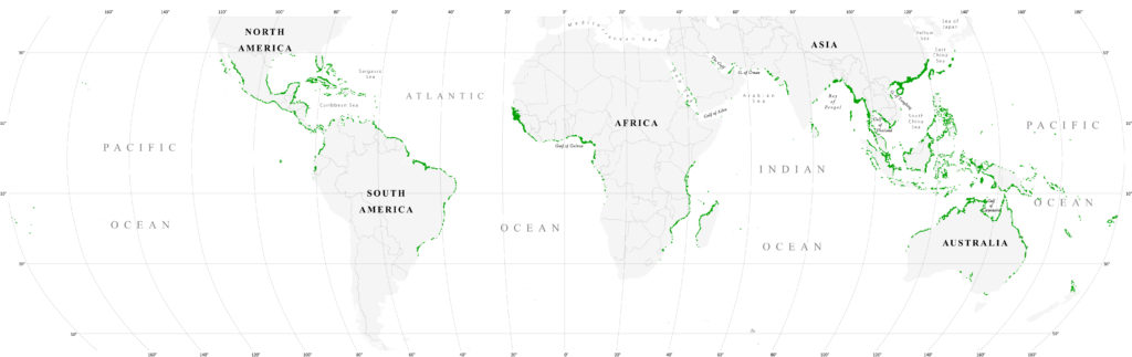
This dataset shows the global distribution of mangrove forests, derived from earth observation satellite imagery. The dataset was created using Global Land Survey (GLS) data and the Landsat archive. Approximately 1,000 Landsat scenes were interpreted using hybrid supervised and unsupervised digital image classification techniques. See Giri et al. (2011) for full details.
Citation
Giri C, Ochieng E, Tieszen LL, Zhu Z, Singh A, Loveland T, Masek J, Duke N (2011). Status and distribution of mangrove forests of the world using earth observation satellite data (version 1.3, updated by UNEP–WCMC). Global Ecology and Biogeography 20: 154-159. doi: 10.1111/j.1466-8238.2010.00584.x .
Use Constraints
UNEP–WCMC General Data License.
For commercial use, please contact business-support@unep-wcmc.org.
data.unep-wcmc.org