
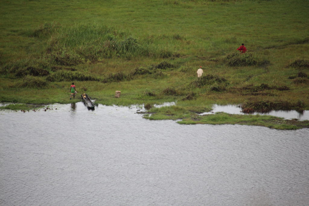
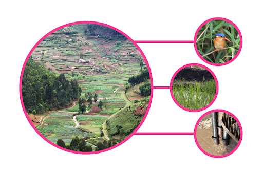
The East African country of Rwanda is also called ‘Land of the Thousand Hills’ – with just as many wetlands. Primarily being used for water provision, food production, and energy generation, Rwandan wetlands are a model example for the need of sustainable ecosystem management in the food-water-energy nexus.
The project Copernicus-based Detection and Monitoring of tropical wetlands in Rwanda (DeMo-Wetlands), funded by the German Federal Ministry of Economic Affairs and Energy (BMWi) through the German Aerospace Center (DLR), was conducted at the University of Bonn and Remote Sensing Solutions GmbH from 2016 to 2019. The overarching goal was to develop Copernicus-based methods for the efficient characterization of tropical wetlands. Rwanda, where population density is one of the highest in African countries and the deterioration of traditionally farmed soils are exacerbated, served as a national demonstrator for the application of these methods. It supports governmental bodies and NGO’s in their conservation activities and planning of sustainable use of wetlands, as well as national authorities in their reporting. In addition, all products were generated in a way that they are compatible with the information requirements from international initiatives such as the SDG’s and the Ramsar convention.
EO Data for Monitoring of Rwandan Wetlands
Reliable and up-to-date spatial information about wetlands is particularly lacking on the African continent. With the increasing amount of freely available high spatial and temporal satellite imagery, and notably the launch of the Sentinels, Earth Observation has the potential to close this gap. Wetland landscapes are complex and variable in space and time. Wetland ecosystems were therefore characterized using time series of Sentinel-1 and Sentinel-2 data, resulting in the following data products:
- Wetland Delineation
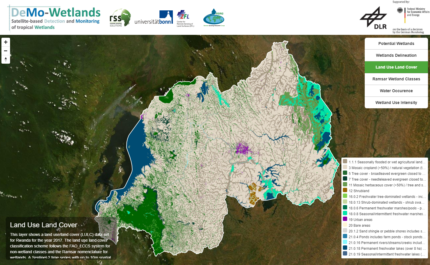
- Land Use Land Cover classification (including version with Ramsar wetland classes)
- Water Occurrence
- Wetland Use Intensity
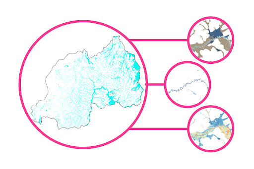
The data layers reflect wetland extent (wetland delineation), full coverage land use and land cover for the year 2017, including wetland categorization according to the Ramsar wetland classes, surface water dynamics from 2014-2017 (water occurrence), and the magnitude of change in vegetation, indicating intensively used and extensively used wetlands (agriculture) and semi-natural systems (wetland use intensity). All layers have a spatial resolution of 10m and each one covers the whole of Rwanda, making them easily combinable and adding value to the characterization scheme. They provide a baseline inventory for the reporting towards international conventions like the Ramsar Convention, the Convention on Biological Diversity, and Sustainable Development Goal indicator 6.1.1 (‘Spatial extent of water-related ecosystems and inland open waters’). User uptake was considerably enhanced through close consultation with both government institutions and non-governmental organizations in Rwanda before, during and at the end of the project. This approach was applied to ensure the remote sensing products were designed in response to the actual stakeholder demand, and to provide methods and products accessible and usable by those stakeholders. Sustainability and availability of the data is ensured through their provision on an online platform. For the near future it is planned that all products will be made available through the GEO-Wetlands Community Portal.
Conclusions and Outlook
Within DeMo-Wetlands, a comprehensive, flexible and applicable approach to wetland characterization was adopted and successfully applied at the national scale of Rwanda. Reflecting the complexity of wetland ecosystems, the layers produced can support a range of management issues and thus foster sustainable wetland management. A detailed wetland inventory was created and can serve as a baseline for further wetland monitoring. However, although the methods were developed to be low-cost and mostly automated, in order to achieve their application by the Rwandan partners, technical expertise in remote sensing has to be further promoted and still not all workflows can be implemented with free software only. The online platform created within the project currently guarantees data availability, but local hosting is envisaged to be implemented, most likely by the Bureau of Statistics, Rwanda (NISR), who are also responsible for national SDG reporting.
Transfer of project results to other countries is desirable and expected to be facilitated by the complementarity of wetland related projects across the continent. Common platforms and networks of specialists are expected to lower the barrier of incorporating operational remote sensing based approaches into national and regional wetland monitoring schemes. However, further tests need to run different climatic and topographic conditions in order to determine the degree to which the methods have to be adjusted.
Rwandan Partner Institutions
- Bureau of Statistics, Rwanda (NISR)
- Rwanda Environment Management Authority (REMA)
- Albertine Rift Conservation Society (ARCOS)
- Association pour la Conservation de la Nature au Rwanda (ACNR)
Point of Contact
Adrian Strauch (University of Bonn) adrian.strauch@uni-bonn.de